AEC Services
Reduce Change Orders
with the Scan to 3D Model Workflow
-

Develop Point Cloud
Same as the Scan to BIM Workflow.
Project site is scanned with Navvis VLX mobile laser scanner. The scanning process captures a point cloud and panoramic images. Open ceiling to access above ceiling utilities. The scanner can be used indoors and outdoors. Point cloud data and images are uploaded and processed.
-

3D Mesh
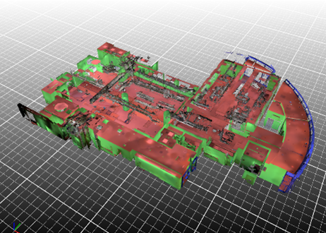
The point cloud is downloaded and then loaded into PointFuse, a 3D meshing program. In this program the point cloud is meshed creating a 3D model. The walls, ceilings, floors, MEP utilities are assigned IFC categories.
-

Clash Detection and Coordination
The 3D mesh created is imported to the design or construction teams Navisworks model. The mesh can then be used to compare against the teams model and identify clashed.
Creating a 3D mesh of an existing building is cheaper and easier than creating a BIM model which makes the mesh a compelling option for design and construction phase coordination.
Improve Accuracy with our
Scan to BIM Workflow
-

Develop Point Cloud
Project site is scanned with Navvis VLX mobile laser scanner. The scanning process captures a point cloud and panoramic images. Open ceiling to access above ceiling utilities. The scanner can be used indoors and outdoors.
Point cloud data and images are uploaded and processed. This process can take 2 to 18 hours depending on the size of the files. The processed data is hosted on the Navvis IVION platform. Login credentials are provided to client and the platform is accessible via web browser.
-

3D Mesh & BIM Elements
The point cloud is downloaded and then loaded into PointFuse, a 3D meshing program. In this program the point cloud is meshed creating a 3D model. The walls, ceilings, floors, MEP utilities are assigned IFC categories. Wall, ceiling, and floor BIM elements are created. A 2D floor plan can be exported directly from PointFuse to .dxf format. The 3D mesh can be exported and used in Revit/Navisworks for coordination and clash detection. The catagories assigned in PointFuse model are maintained in the export to Revit.
-

BIM Model
Now the BIM model can be developed further to meet the project needs.
Improve Communitaion and Documentation with
Construction Phase Progress Scanning
-

IVION Platform for Project Coordination
The point cloud and images are stored on the IVION platform, Log on credentials can be provided to all project stakeholders to access and use the information.
Scans can be completed at regular intervals, allowing users to check past installations after walls and ceilings are closed. All data files can be downloaded by Client and stored for future use,
-

Coordination with Project Team
Capturing your entire project site with a scan, share it with all project stakeholders and collaborate in the space.
Take measurements in the user interface, save them, add comments and share them with other team members via email and pdf. Hyperlinks will take the recipient to the location in the user interface.
-

Document Key Information for Turnover
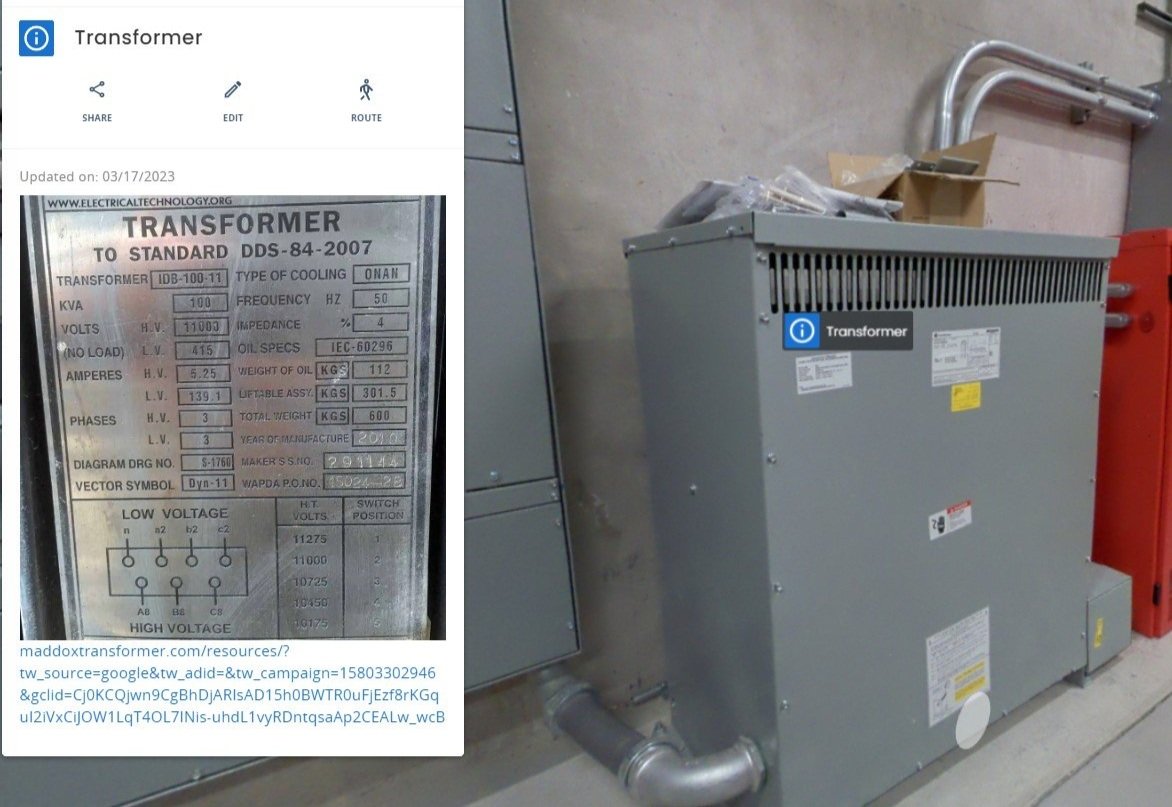
Document point of interest in the user interface. Add detailed photos, manuals, audio recordings.
This feature can be used to document issues during a punch walk or to document equipment locations and details for handoff to facilities.
-

High Resolution Panoramic Images & Point Cloud
Capture high resolution, panoramic images of the project site and a point cloud with each scan. These can be referenced at any time to see where utilities are in walls and above ceiling.